Marr’s Ridge Trail
The trail is on private property that Whitefield landowners have generously opened for public use. Please stay on trails and respect the landowner’s privacy. Midcoast Conservancy protects a portion of the property through a conservation easement.
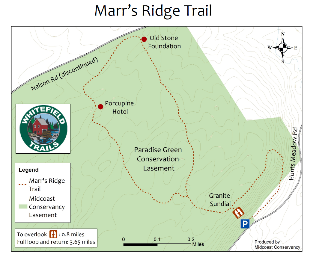
The Marr’s Ridge Trail, features several large granite structures including a tower that serves as a sundial, erected by the landowner. You can also look out over the Sheepscot River valley and see as far east as Ragged Mountain and the Camden Hills, including Mt. Battie.
Midcoast Conservancy holds a conservation easement on the Paradise Green property.
This trail is maintained by our partners, the Whitefield Trails Committee. The Whitefield Trails Committee was formed by a group of local citizens in the fall of 2013 when the Whitefield Community Forum indicated a strong desire for more recreational trails in town. The Trails Committee identified several potential areas for trails and got to work opening its first trail in the summer of 2014.
The all-volunteer Whitefield Trails Committee continues its work, currently maintaining three trails, and is working to develop others for the enjoyment of the public. Future trails may include access to the Sheepscot River and a field trail suitable for running and cross-country skiing.
Directions:
Marr’s Ridge Trail
Whitefield, ME 04353
From the West: From the Gardiner bridge over the Kennebec River, follow Route 126 east for 6 miles to the intersection with Hunt’s Meadow Road. Turn left and continue 1.5 miles on Hunt’s Meadow Road to the trailhead and parking on your left.
From the East: Follow Route 126 west from Damariscotta Lake for 7.3 miles to the Cooper Road which bears right opposite St. Denis Church. Go north on the Cooper Road for 1.8 miles and turn left onto Hunt’s Meadow Road. Go 0.7 miles to the trailhead and parking lot on your right.